Situated in the eastern part of the Atlantic Ocean, between the meridians 16° 39' and 17° 16' W and the parallel 32° 38' and 32° 52' N, the Madeira Archipelago stands under the oceanic substrate of the African tectonic plate and is an example of intraplaca oceanic volcanism, which is a "hot-spot" whose activity began more than 5.2 million years ago.
This type of volcanism is the result of a plume of magma that rises from the mantle to the crust, which is associated with the movement of the African plate towards W-E and resulted in the formation of the chain of Islands and islets that make up the archipelago.
In lithological terms Madeira Island, with an area of 742 Km2 corresponds to the accumulation of volcanic materials, essentially explosives, as is the case of pyroclastic rocks that as the dimension are sorted ash, lapilli (locally known as gravel) and volcanic bombs, and effusive, ranging from basalts to trachyte, and resulted from magmas fluids, poor in silica and with predominance of mafic terms (dark). These igneous rocks are characterized by a texture (amorphous mass), resulting from the consolidation of the surface magma (rapid cooling) which prevented the formation of well-developed crystals.
The geological importance of the municipality of Santana, is expressed by the eruptive volcanic episodes occurring diversity along approximately 17 million years ago, from the Miocene to the Pleistocene, identifying four periods chronologically demarcated, individualized in four main volcanic complexes:
The base or former volcanic complex, consisting essentially of pyroclastic materials, comprises the submerged part of the island and the base of the emerged land and represents about 25% of the area of the municipality, including:
- Dykes and veins;
- “Homem em Pé”;
- “Pico Ruivo” and Peaks of the Central Mountainous Massif.
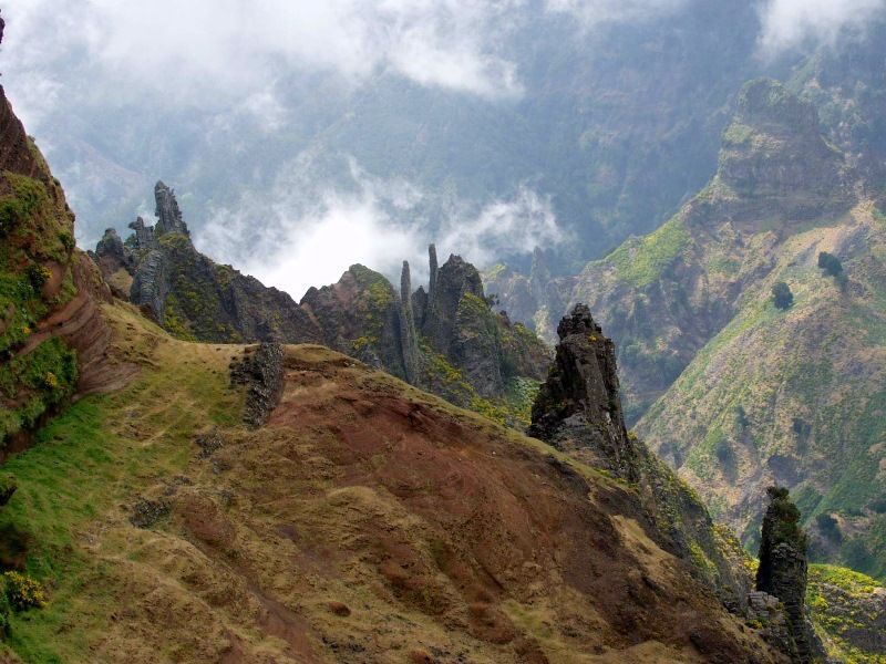
Volcanic landscape in the Central Mountainous Massif
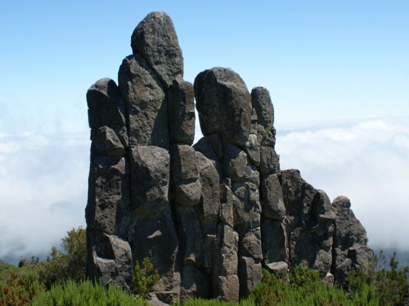
Geomonumento "Homem em pé".
The peripheral volcanic complex is located largely in the periphery of the island, and is composed of alternating pyroclasts and countertops of lava with high slopes. In Santana there are some features that are worth highlighting:
- Leaked molten columnar disjunction
- Leaked molten lamellar disjunction
- Rock mass of “Penha d ' Águia”
- Rock formation "A Cara" - "The Face"
- Outcrop of São Jorge
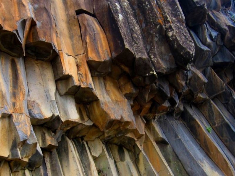
Prismatic disjunctions of the mouth of the “Ribeira do Faial”
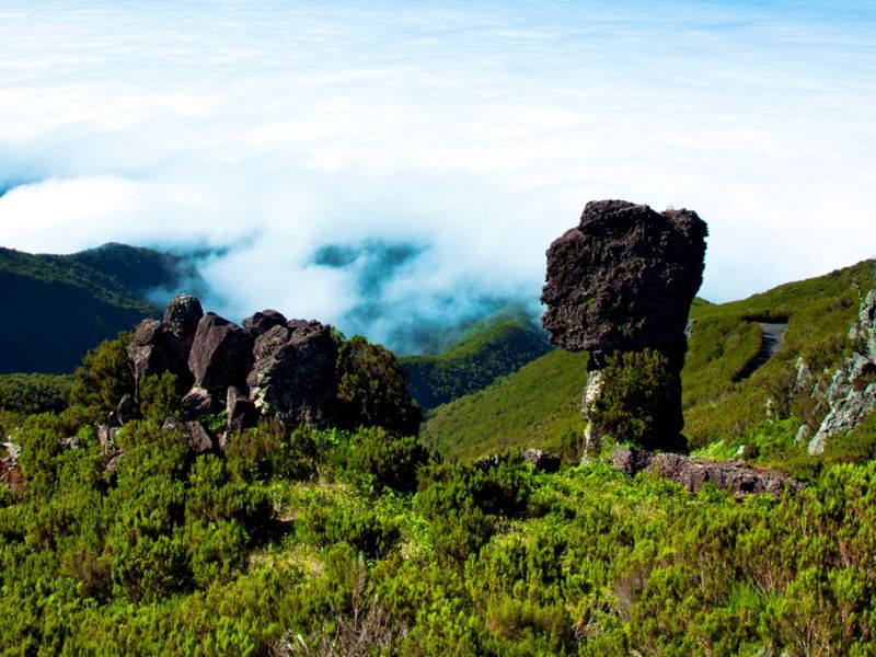
Rock formation "A Cara" - "The Face"
The volcanic complex of “Lombardas Superiores”, lies mostly above 500 meters above sea level and comprises the interfluve crests separating the valleys of drained basins, known locally as "loins" (lombos) and "bumps" (lombadas). This complex is characterized by an alternation of tephra and lava little bushy, lithology similar to peripheral volcanic complex.
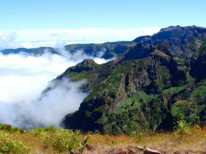
The volcanic complex of “Lombardas Superiores”
The volcanic complex of Paúl da Serra is the latest volcanic. In lithological terms, it is characterized by basaltic lavas not too inclined and sub-horizontal, interspersed with thin layers of pyroclastics, derived mostly from rashes. The “Achada do Teixeira” represents the best example of this complex in the municipality of Santana.
Still in Santana there are other geological formations associated with secondary volcanic apparatus of high landscape value, as in the case of “Pico Redondo”, in “Arco de São Jorge” and the “Pico da Boneca”, a volcanic cinder cone located between “Pico do Clérigo” and the islet of the widow (ilhéu da Viúva). The weathering of volcanic materials gave rise to other geomorphological formations of sedimentary character as the stone beaches.
Like the rest of the island, Santana has a very accentuated relief, with an average slope of 56%, which is associated with a strong rainfall is responsible for the occurrence of deep valleys and fitted with rain.
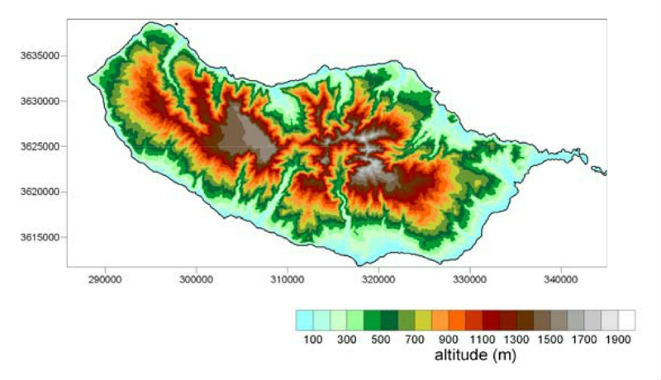
Madeira's orography (Source: CLIMAAT II).
The coastline is characterized by high and steep cliffs, pebble beaches, usually associated with the mouth of small rivers and landslides resulting from the gravitational instability of the cliffs and marine abrasion, of which stands out the “Fajã da Penha d ' Águia”, formed in February 1992, as a result of the collapse of a part of this rocky complex. It is also highlighting the asymmetry between the southern and northern slopes, resulting from faster retreat of the cliffs of the North Coast, as a result of hydrodynamics and prevailing NE winds.
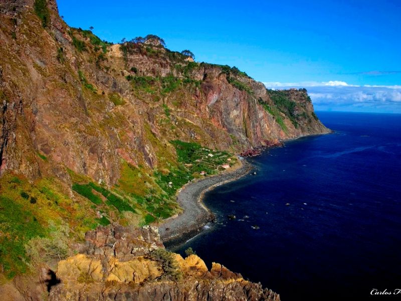
Santana's coastline
References
- Ribeiro, O. (1985), A Ilha da Madeira até Meados do Século XX, Estudo Geográfico, Instituto de Cultura e Língua Portuguesa, 1ª edição, Lisboa.
- Diário da República, 1ª série, Nº160 – 20 de Agosto de 2008 (PRAM) http://dre.pt/pdf1sdip/2008/08/16000/0576905837.PDF
- CLIMAAT - Clima e Meteorologia dos Arquipélagos Atlânticos II (2006), Impactos e medidas de adopção às alterações climáticas no Arquipélago da Madeira, Direcção Regional do Ambiente, Funchal.

